|
|
Broad Ripple Random Ripplings


The news from Broad Ripple
Brought to you by The Broad Ripple Gazette
(Delivering the news since 2004, every two weeks)

|
| Brought to you by: |

|

|

|

|

|

|
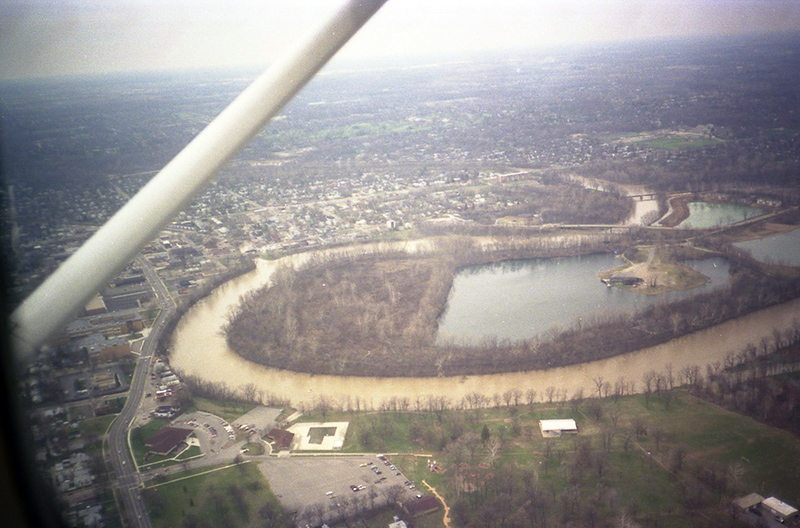
Random Historic Photo - Dawson Lake 1989
posted: Sept. 21, 2023

This photo is from about 1989. We took this from a plane ride around the Broad Ripple area. This shows the White River and Dawson Lake, now Oxbow. There was a large peninsula in the lake from when this was a gravel pit.
Broad Ripple Avenue runs from behind the airplane strut to the bottom of the photo on the left. It is easy to see how it changes from 63rd Street in the Village to 62nd Street near the park. On the left side of the street is Broad Ripple High School and Flanner and Buchanan. The small row of buildings on the right side is Weaver's Lawn and Garden.
At the bottom of the photo is Broad Ripple Park. The old family center is on the left. The old three-rocket climbing gym can be seen in the middle at the bottom.
alan@broadripplegazette.com
|
|
|
|
| Brought to you by: |

|

|

|
| Brought to you by: |

|

|
|
|
|||
|
Copyrighted Property Of Broad Ripple Publishing
Site terms Broad Ripple Random Ripplings is hosted at Ionos.com |

