|
|
Broad Ripple Random Ripplings


The news from Broad Ripple
Brought to you by The Broad Ripple Gazette
(Delivering the news since 2004, every two weeks)

|
| Brought to you by: |

|

|

|

|

|

|
Converted from paper version of the Broad Ripple Gazette (v15n04)
Everything you always wanted to know about the canal...part eighteen - Downtown canal part 3
posted: Feb. 16, 2018
Part Eighteen - The Downtown Canal part 3
The Broad Ripple Gazette presented (in various issues from Volume 12 #18 through Volume 13 #9) the history and workings of the Indiana Central Canal as it exists today, from the canal's creation at the dam on the White River in Broad Ripple, down to the Citizens White River Treatment Plant near the Fall Creek and 16th Street.
This article is the third part that covers the portion of the canal that was past the water treatment plant. It currently runs from 11th Street, through downtown and White River State Park, "spilling over" into the White River near the southwest corner of the NCAA Hall of Champions.
From part 2 to start this installment:
In 1976 the IWC deeded the downtown portion of the canal to the City of Indianapolis. This was a 2.25 mile stretch.
In 1986 the construction began with funding from the Urban Mass Transit Administration, Indianapolis Department of Transportation, the State Office Building Commission, the Lilly Endowment, and the Indianapolis Foundation. [Bakken, J. Darrell. Now That Time Has Had Its Say. 1st Books. 2002]
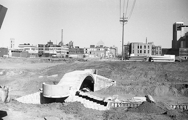
The existing canal was drained south of Interstate 65. The canal bed was lowered 12 feet and the canal channel was lined with concrete to a uniform width of 50 feet. The exceptions were for basins at Ohio, New York, Walnut and 11th Streets. Pedestrian walkways were to be added to both sides.
This first project, running from 1985 through 1991, cost $14,400,000. This seven-block section included the portion of the canal that ran from West Street, south of Ohio Street, north to St. Clair Street.
Several vehicular bridges that crossed the canal were replaced during these years. Those bridge projects were under the Department of Transportation and were not part of the canal project. The bridges included Ohio, New York, Indiana/Michigan, North, St. Clair, 10th and 11th Streets. The canal project included new pedestrian bridges at Vermont and Walnut Streets, where vehicular bridges existed before. The vehicular bridge at 9th Street was planned to be replaced with a pedestrian bridge, but was simply removed around 2000 when the north section of the Canal Walk was built.
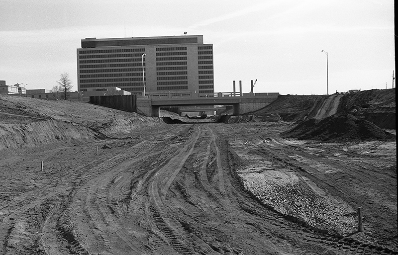
Phase one of the project, started in 1985, was to move the canal into an underground 54-inch pipe from the West Street Bridge to the White River. This pipe provided a temporary overflow for the downtown canal system.
In 1986, phase two lowered the canal from West Street to New York Street and built the Ohio Street basin and fountain. This is the area where the canal is supplied with water. As I mentioned in a previous installment, I had always thought that the downtown canal was an extension of the Broad Ripple canal. I had heard that the water flowed south from Broad Ripple, went underground at the Interstate, then re-emerged at 11th Street. In fact, the downtown canal is more like a pond. It is a non-flowing, contained structure fed by two main water sources - the AUL Tower (now OneAmerica) and the Indiana State Office Building. The AUL water is from the ground water pressure from the hole dug for the underground parking. The State Office Building outputs the used geothermal water into the canal. The relatively warm temperatures of these waters are why the Ohio basin does not freeze in the winter. The waterfall feature on the north end of the canal by Buggs Temple, fed by pumping ground water into the canal, keeps the water moving in the summer months so it doesn't become stagnant. That feature typically only runs April through October, because it would freeze in the winter.
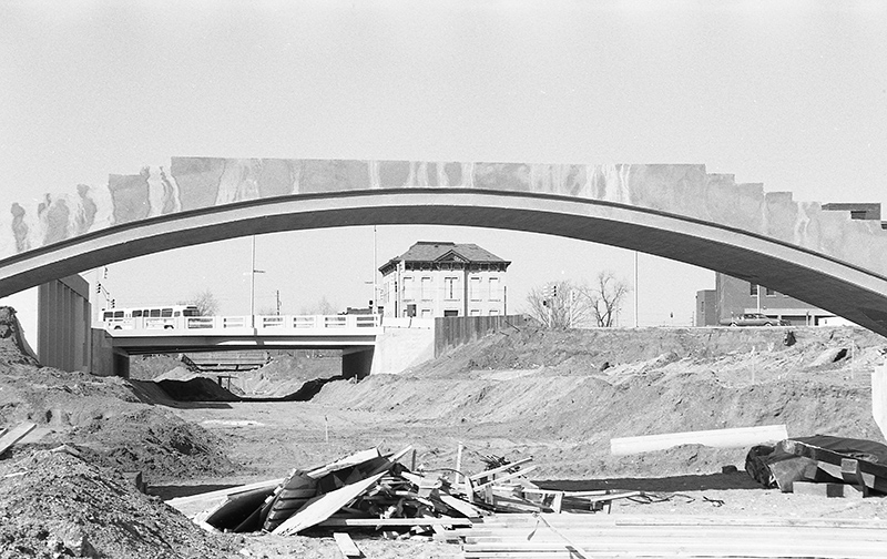
Phase three took the canal north past Michigan Street. The pedestrian bridge was at Vermont Street was built. A basin wide enough to turn a watercraft around was constructed between the pedestrian bridge and New York Street.
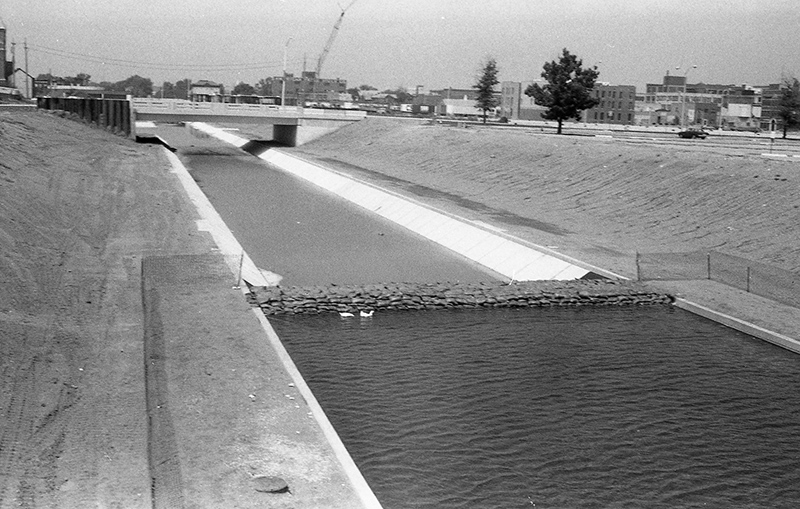
Taken during the canal reconstruction around 1988, this is looking east from the new Vermont Street walking bridge. The World War Memorial is visible in the back.
Taken during the canal reconstruction around 1988, this is looking north from about New York Street.
alan@broadripplegazette.com
|
|
|
|
| Brought to you by: |

|
|
|
| Brought to you by: |
|
|

|
|
|
||||
|
Copyrighted Property Of Broad Ripple Publishing
Site terms Broad Ripple Random Ripplings is hosted at Ionos.com |
||||

